The general objective of Land degradation application is to develop an operational information service that support policy and decision making at regional and national level towards improved food security; integrated water resource management and informed drought management initiatives. Land degradation service generates evidence based decision support tools in foam of maps and bulletins. Specifically LD Service aims at:
- Assessing extent and severity of land degradation at regional level, national level and localized hotspots using earth observation technology
- Build technical capacity of national institutions and relevant stakeholders to generate monitoring service for land degradation
- Raise awareness of land degradation interconnected issues with policy and decision makers towards land degradation neutrality (restoration)
This will be achieved through: consolidation, strengthening, enhancement and further development of operational information service. The concept service here therefore refers to the process of products development, products enhancement, validation and generation of regular and timely information in the form of maps and bulletins at regional and national levels. The consolidation of LD service will be based on lessons learnt and gaps identified in its implementation during predecessor MESA and AMESD. This will include improved methodology, inclusion of additional indicators, and improved dissemination strategy. More emphasis will be laid on how the service contributes to decision-making process through greater involvement of champion users in the service development at national level. This will ensure a greater sense of ownership and continuity of the service development.
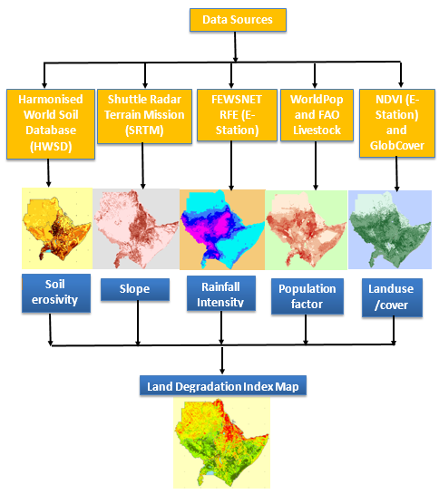
Land Degradation Modelling Framework


